Gokyo Valley Nepal is one of those Himalayan places where the scenery is only the beginning of the story. The valley lies in Sagarmatha National Park in the Khumbu region, surrounded by high mountain passes, glaciers, lakes and some of the best known peaks in the Everest region. Gokyo village, Gokyo Ri and the surrounding trails have also made the area an important part of the Gokyo Valley Trek.
Yet Gokyo is not only about reaching a viewpoint and taking photographs. Sherpa culture, Buddhist traditions, yak herding and life at high altitude are all part of what gives the valley its identity. From Gokyo Ri, the views extend toward Everest, Cho Oyu, Lhotse and Makalu, creating one of the most memorable mountain panoramas in Nepal.
How does the geography of Gokyo Valley shape life here? What is the climate like across the seasons, and what makes its mountain landscape so distinctive?
This guide explores Gokyo Valley’s geography, culture, climate and mountains, along with the places, people and experiences that make this corner of the Nepal Himalayas worth understanding beyond the usual trekking itinerary.
Gokyo Valley Geography
Gokyo Valley belongs to the upper Dudh Koshi river system in the Khumbu region of Solukhumbu. The valley is part of Sagarmatha National Park and includes the Gokyo wetland, which is listed as a Ramsar site.
The elevation also changes across the Gokyo area. Gokyo village and the main lakes are around 4,750 metres above sea level, while Gokyo Ri reaches 5,357 metres. Farther north, the landscape continues toward Cho Oyu and the Nangpa area.
The Ngozumpa Glacier is one of the defining geographical features of Gokyo Valley. Its lower end reaches the area near the lakes, and the glacier supplies part of the water entering the Dudh Koshi system. The Nepal Tourism Board describes Ngozumpa as the largest glacier in Nepal.
At this altitude, forests are no longer part of the landscape around Gokyo village. Small plants and grass can survive in places during the warmer months, while exposed rock, moraine and snow cover much of the higher ground.
The geography has also shaped how people use the valley. Summer yak grazing is an established part of life in Gokyo, while the high elevation limits large scale agriculture. The wetland and surrounding land also provide habitat for several bird species, including migratory birds that pass through the Himalayas.
History of Gokyo Valley
Gokyo has a history that is more pastoral and religious than political. For generations, Sherpa families used the high pastures for summer yak grazing, bringing livestock into the area when conditions allowed and moving them back toward lower country before the harshest part of the year. Older field research describes the upper valley as largely uninhabited outside this seasonal use.
The area also formed part of the older Khumbu and Tibet trade network. The nearby Nangpa La was a traditional route between Tibet and the Khumbu, used by Sherpa traders and others crossing the Himalaya. This gave the northern side of the region an importance that had little to do with modern tourism.
Religion is another old part of the story. The high lakes have been regarded as sacred for generations, and pilgrimage, particularly during Janai Purnima, remains part of their cultural importance. The surrounding mountains and water sources also feature in Sherpa sacred geography.
The biggest change came with the growth of international tourism in the Khumbu during the twentieth century. What had largely been a seasonal pastoral landscape gradually gained lodges and other tourism services, giving Gokyo a much more permanent role in the modern economy of the region.
Sherpa Culture and Religion in Gokyo Valley
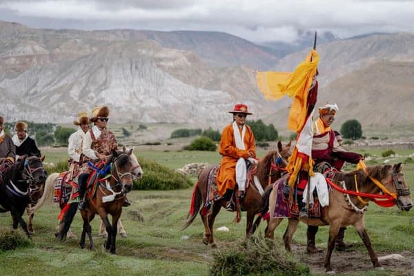
Sherpa life in Gokyo has traditionally depended on yak herding, small scale farming and seasonal movement between pastures. Tourism now provides another important source of income, with local families running teahouses and lodges and working as trekking guides and porters along the Gokyo Valley Trek.
Yaks are taken to higher grazing areas during the warmer months and provide milk, meat, fibre and transport. Potatoes and a few other crops suited to cold conditions can be grown in the area, although farming is limited by the altitude, short growing season and lack of cultivable land.
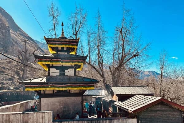
Buddhist traditions are deeply woven into life in the Khumbu. Mani stones, chortens, prayer wheels and prayer flags are common around villages and trekking trails, while local customs reflect the influence of Tibetan Buddhism on Sherpa communities.
The Gokyo Lakes have particular religious importance for both Hindus and Buddhists. During Janai Purnima, pilgrims travel to the lakes for ritual bathing and worship. The combination of Sherpa traditions, Buddhist practices, seasonal yak herding and religious pilgrimage gives Gokyo Valley a cultural character that visitors will not find by looking at the mountains alone.
Gokyo Ri and the Mountains of Gokyo Valley
Gokyo Ri, also known as Gokyo Peak, reaches 5,357 metres above sea level. It stands on the western side of the Ngozumpa Glacier, above Gokyo village. The summit is one of the highest accessible viewpoints in the Khumbu and gives a broad view across the surrounding Himalayan range.
Four of the world’s 8,000 metre peaks can be seen from Gokyo Ri: Mount Everest, Lhotse, Makalu and Cho Oyu. Cho Oyu lies north of the valley, while Everest, Lhotse and Makalu appear across the eastern and southeastern horizon. Pumori, Nuptse and several other peaks of the Mahalangur Himal are also visible from the upper slopes.
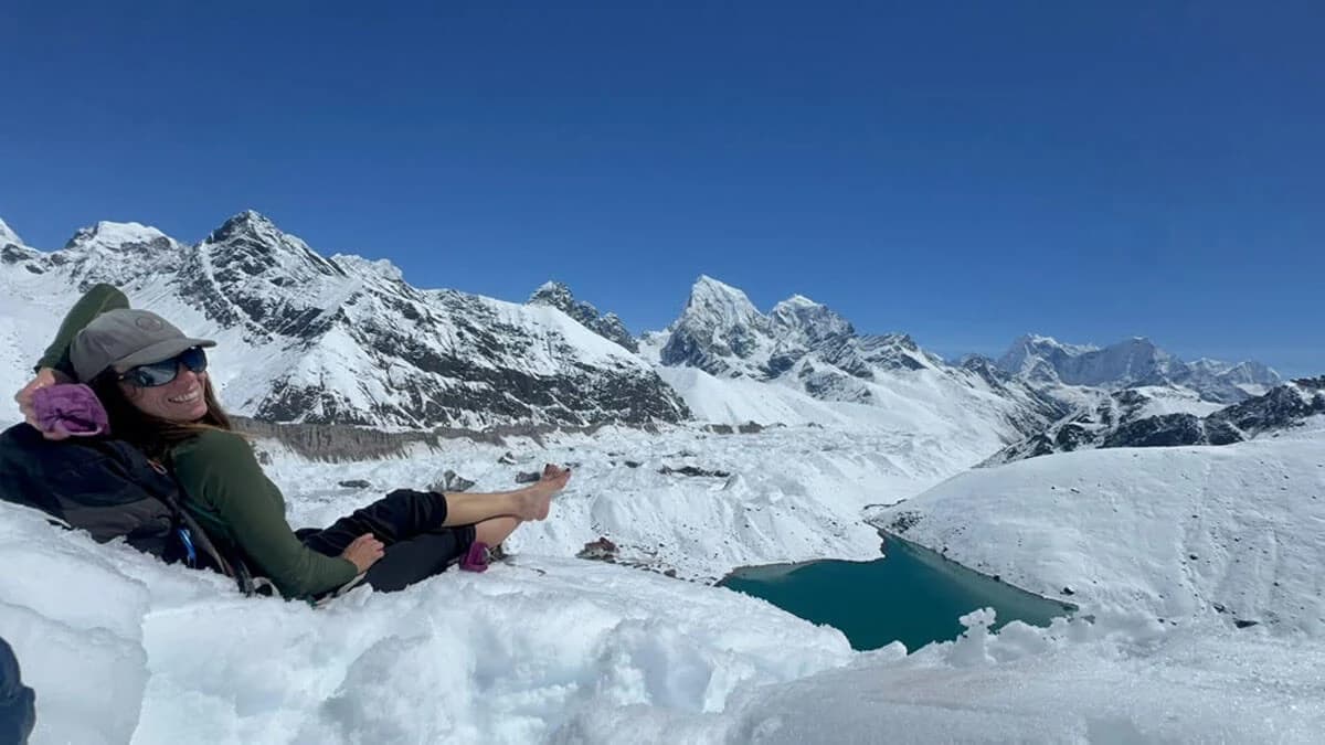
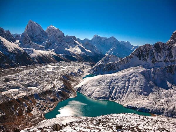
The position of Gokyo Ri is what makes your Nepal trekking journey worth it. The Ngozumpa Glacier lies directly below, with Gokyo village and its surrounding high altitude landscape beside the glacier. Beyond the ice and rocky ridges, the great peaks rise across the horizon. The viewpoint therefore brings together glacier, valley, and high mountains in a single landscape.
The ascent begins from Gokyo village and gains approximately 600 metres before you reach the summit. The thin air at more than 5,000 metres makes the climb very different from an ordinary mountain hike.
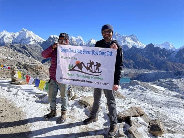
Gokyo Ri also lies within a network of historic and modern trekking routes across the Khumbu. The Cho La Pass connects the Gokyo Valley with the Everest Base Camp route, while Renjo La Pass leads toward the Nangpa Valley and Thame. These routes form part of the wider Everest Three Passes Trek, linking several high valleys around the Everest region.
From Gokyo Ri, the relationship between the major features of the area becomes especially clear. The Ngozumpa Glacier occupies the valley floor, Cho Oyu shows up the northern skyline, and Everest, Lhotse and Makalu form the distant mountain horizon. This geography is a major reason Gokyo has become one of the most recognised mountain viewpoints in Nepal.
How to Reach Gokyo Valley
Gokyo Valley lies in the Upper Khumbu region of Nepal, beyond Namche Bazaar and the Dudh Koshi river corridor. There is no road to Gokyo village and no permanent airport in the valley, so access depends on the surrounding villages, mountain trails and air transport.
Your Gokyo valley journey will begin at Tenzing Hillary Airport in Lukla, the main air gateway to the Everest region. From Lukla, you will head north toward Namche Bazaar, the Sherpa town that grew with Everest, and then west toward Dole and Machhermo. Gokyo village lies at the end of this side valley beside the Gokyo wetland and Ngozumpa Glacier.
The Gokyo Lakes Trek 14 days connects with other routes across the Khumbu Valley, including trails toward Everest Base Camp, Renjo La and Thame. Helicopter tour to Gokyo is also possible, subject to weather, aviation conditions and operational permissions. This provides an alternative form of access for sightseeing, private travel and emergency evacuation.
What is the Climate Like in Gokyo Valley?
Gokyo Valley has an alpine tundra climate because most of the valley lies above 4,700 metres. Freezing temperatures occur through much of the year, and the coldest conditions happen during winter. The high elevation also creates a large difference between daytime and nighttime temperatures.
January is the coldest month in Gokyo, while July has the highest average temperature and receives the most precipitation. The annual temperature range is limited compared with lower parts of Nepal because even the warmest months remain comparatively cold.
The Gokyo Valley monsoon runs mainly from June to August. Rainfall is influenced by the South Asian monsoon, although precipitation at this elevation can occur as snow. July is the wettest month in available climate records.
From December into February, temperatures can remain below freezing for long periods and the Gokyo Lakes may freeze. Snow and ice are also common around the higher parts of the valley, while the ground around Gokyo village can remain frozen during the coldest months.
The Gokyo Valley temperature is strongly affected by altitude, exposure and time of day. Conditions at 4,750 metres are substantially colder than those at Namche Bazaar, which lies at about 3,440 metres.
Villages Around Gokyo Valley
The names along the upper Dudh Koshi are not all villages in the same sense. Dole and Machhermo have a more established local presence, while Lhabarma and Luza are smaller high altitude places closely connected with seasonal pasture use.
Dole, at about 4,038 metres, is the point where the landscape begins to look distinctly alpine. Birch and rhododendron grow around the area, and yak grazing has long been part of local life. Today, Dole also has several family run lodges and teahouses.
Further north are Lhabarma and Luza, at approximately 4,220 and 4,360 metres respectively. These are small hamlets rather than large communities. Families from the Khumbu have traditionally used this part of the valley for livestock and seasonal pasture, moving animals between higher and lower grazing areas as conditions change.
Machhermo, at around 4,470 metres, is the most substantial community before Gokyo. Its location beside the Dudh Koshi and its access to pasture made it useful for yak herding long before tourism became important. It now has lodges and a Himalayan Rescue Association aid post, which has provided high altitude medical support in the area.
At approximately 4,790 metres, Gokyo is the highest and best known village in the valley. Its houses are concentrated around Dudh Pokhari, with grazing areas extending beyond the built up area. The village is closely connected with the local Sherpa economy, where tourism now plays a major role alongside livestock keeping.
Wildlife and Biodiversity of Gokyo Valley
Gokyo Valley is part of Sagarmatha National Park, but its ecology changes sharply with altitude. The lower part around Dole has birch and rhododendron, while areas closer to Gokyo have very little tree cover. Alpine grasses, mosses, small flowering plants and other cold tolerant vegetation survive in places where the soil and water allow them to grow.
The Gokyo Valley wildlife is closely connected with the wider Khumbu ecosystem. Himalayan tahr and musk deer occur in the national park, while the higher rocky country provides habitat for the snow leopard and its prey. These animals range across large areas and are rarely seen around Gokyo village itself.
Birds are more closely connected with the valley's wetland habitats. Himalayan monal and blood pheasant are among the bird species recorded in the wider Sagarmatha region. The lakes, streams and marshy areas around Gokyo provide feeding and resting places for birds, including species that move through the Himalayan region seasonally.
The plant life becomes increasingly sparse above the tree line. There are no forests around Gokyo village, and the short growing season limits the variety of alpine flora. Mosses, grasses and small plants can survive in sheltered areas, while exposed slopes and glacial deposits support very little vegetation.
This makes Gokyo Valley biodiversity closely tied to altitude. The lower Dudh Koshi corridor supports woodland species, the higher pastures support grazing animals, and the land around Gokyo contains wetland and alpine habitats. Together they form a small but varied high altitude ecosystem within Sagarmatha National Park.
How High Altitude Shapes Life in Gokyo
Above 4,700 metres, cold temperatures and the short growing season put clear limits on agriculture. Around the upper Khumbu, people have traditionally relied more heavily on livestock and high altitude pastures than on crop farming.
Yak herding is suited in these high altitude areas. Yaks can graze on short alpine grass and are used for milk, meat, fibre and carrying loads. Herds are moved between grazing areas as the seasons change, which makes seasonal pastoralism an important part of local life.
Potatoes and a few other cold tolerant crops can grow in suitable parts of the wider Khumbu, but the higher areas do not provide enough productive land for agriculture to become the main livelihood.
Family run lodges, food services, guiding and livestock transport now form part of the local economy alongside traditional pastoral activities.
The result is a high altitude lifestyle shaped by yak husbandry, seasonal grazing, limited farming and tourism, with each becoming more or less important according to elevation and season.
Gokyo Valley and the Nangpa Trade Route
The Nangpa La trade route connected Khumbu with Tibet long before modern tourism developed in the region. The high pass provided a traditional route for Sherpa traders and Tibetan communities to exchange goods and maintain links across the Himalayas.
Trade included products such as salt, wool and grain, which were important to the mountain economy of Khumbu. The route also had religious importance and formed part of the wider trans Himalayan trade network.
Nangpa La is located north of the Gokyo area, near Cho Oyu, and its history helps explain Gokyo’s connection with the wider Himalayan borderlands. The region was not isolated from the world beyond Khumbu; people, goods and religious traditions moved through these high mountain routes for generations.
Final Thoughts
There is a reason people remember Gokyo long after leaving the Khumbu. It is not just the view from Gokyo Ri or the sight of the lakes. It is the feeling of being in a place where the landscape, local life and old mountain traditions still belong together.
Gokyo gives you a chance to see a different side of the Everest region. You see how people have adapted to life at high altitude, how trade and religion shaped the area, and how the mountains continue to influence everyday life.
Once you understand what lies behind the scenery, Gokyo becomes more than another stop on a trekking map. It becomes a place with a story of its own.